Interlaken Ost - Harder Kulm


- 2:30 h
- 4.10 km
- 758 m
- 1 m
- 566 m
- 1,325 m
- 759 m
- Start: Interlaken Ost, train station
- Destination: Panorama Restaurant Harder Kulm
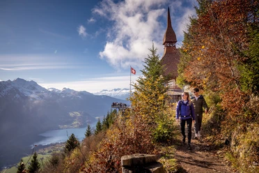
From Interlaken Ost train station, the path leads along the Aare River to the valley station of the Harderbahn and through several, partly very steep hairpin bends through the Bleikiwald to the Falkenfluh - a viewpoint located above the front of Hardermanndli. The rock falls almost vertically below the railing, Interlaken can be seen from a bird's eye view, above it the magnificent mountain range of Eiger, Mönch and Jungfrau. On the well-developed mountain path, the pleasant ascent continues over the wide mountain meadow, with views of Lake Thun and the distinctive pyramid of the Niesen. Past the bustle on the viewing terrace of the Harder Kulm mountain restaurant, the wide panoramic path finally leads to the mountain station of the Harderbahn.

Good to know
Pavements
Best to visit
Directions
Interlaken Ost - Bleikiwald - Hardermanndlis - Harder Kulm
Equipment
Normal hiking equipment, hiking shoes with grippy soles, hiking poles facilitate the ascent.
Directions & Parking facilities
Via Bern or Lucerne to Interlaken. From the south via Grimsel Pass (summer only) or via Simplon Pass and Lötschberg car shuttle to Interlaken.
Open-air parking directly next to the Interlaken Ost train station.
Arrival and departure via Interlaken Ost train station.
Additional information
Hike 72
(in the printed summer panoramic map of the Jungfrau Railways)
License (master data)
Safety guidelines
Mountain hiking trail with some exposed sections; outside the marked trail, the terrain is partially very steep and exposed, especially at the front of Hardermanndli - therefore do not leave the path!
Nearby


")
