Interlaken - Goldswil - Baumgartisegg - Harder Kulm

- 3:25 h
- 6.77 km
- 951 m
- 214 m
- 566 m
- 1,435 m
- 869 m
- Start: Interlaken Ost, train station
- Destination: Harderbahn, mountain station
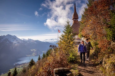
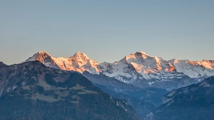
From Interlaken Ost, the hiking trail passes the valley station of the Harderbahn on the left, heading east towards Goldswil. The steep path zigzags up through the dense beech forest, via Ried to the Harder ridge. Along the ridge, it now gently descends to the sunny terrace of the Harder Kulm restaurant. A fantastic view is offered. The descent can be undertaken by cable car or on foot.

Good to know
Pavements
Best to visit
Directions
Interlaken - Goldswil - Ried - Harder Kulm
Equipment
Normal hiking equipment, hiking boots with good grip soles.
Directions & Parking facilities
Via Bern or Lucerne to Interlaken. From the south via Grimsel Pass (only in summer) or via Simplon Pass and Lötschberg car shuttle to Interlaken.
Uncovered parking directly next to Interlaken Ost train station.
Arrival and departure via Interlaken Ost train station.
Additional information
(in the printed summer panoramic map of the Jungfrau Railways)
License (master data)
Nearby


")
