- 3:50 h
- 10.70 km
- 590 m
- 750 m
- 797 m
- 1,394 m
- 597 m
- Start: Goldiwil
- Destination: Sigriswil
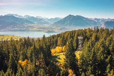
Following the road you reach the church, the center of the elongated village. Wonderful is the view of the Bernese Alps mountain range, while the gentle crossing of the upper Cholere valley from Hintermatt to Äbnit offers views of the lower Thun lake basin, Belpberg, Gurnigel and Stockhorn range. Into the forest you climb up to the road and reach the Heiligenschwendi Höhenklinik. The path now leads over a forest ridge up to the observation tower on the Blueme.
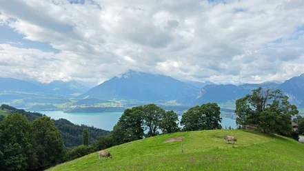
High above the fir treetops you enjoy a magnificent panoramic view. The descent over the wide ridge of the Margel and via Tschingel to Sigriswil is like a beautiful panorama hike. The deep blue lake contrasts wonderfully with the green meadows surrounding it and with the mountain peaks on the horizon.

Pavements
- Trail (60%)Asphalt (18%)Path (22%)
Best to visit
- suitableDepends on weather
Directions
- Goldiwil - Heiligenschwendi - Blueme - Sigriswil
Equipment
- We recommend the following equipment: light trekking shoes, light backpack, sun protection, rain jacket, pocket pharmacy, light picnic, enough fluids.
Additional information
- Association Berner Wanderwege, Bern, Tel.: 031 340 01 01, E-Mail: info@beww.ch, Homepage: www.bernerwanderwege.ch
Literature
Hiking suggestion from the hiking book Thunersee - Frutigland, hiking book series by BWW, order at: http://shop.bernerwanderwege.ch
License (master data)
Safety guidelines
- This route runs entirely on hiking trails.
Map
Swisstopo hiking map 1:50,000 253T Gantrisch