On the Trail of the Häliloch


- 3:30 h
- 10.54 km
- 230 m
- 1,040 m
- 1,121 m
- 1,950 m
- 829 m
- Start: Niederhorn
- Destination: Beatenberg Schmocken
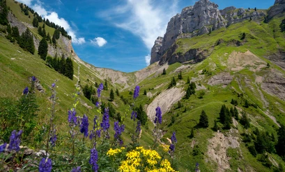
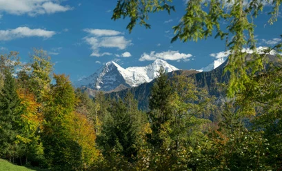
After a spectacular journey up to the Niederhorn via funicular and gondola, the mountain trail winds along the Güggisgrat, offering magnificent views of the Eiger, Mönch, and Jungfrau. At Oberburgfeld, the trail branches off to the right and continues slightly downhill past the Häliloch, which is part of the massive underground cave system known as Sieben Hengste-Hohgant. The cave can be admired from a distance: It is not accessible to hikers and drops vertically for about 100 meters; caution is advised. The trail continues through Underburgfeld and soon reaches the striking rock spire known as the Bire. Those who dare can climb up to the lookout point here. The route continues along the rock faces—exposed and on a narrow path—along the Bireflue, partly on narrow trails via Känzeli into the Dälewald. For the final few kilometers, the trail leads through a shady forest down to Beatenberg.

Good to know
Pavements
- Trail (14%)Path (76%)Asphalt (3%)Gravel (1%)Street (6%)
Best to visit
- suitableDepends on weather
Directions
- Niederhorn – Oberburgfeld – Häliloch – Unterburgfeld – Bire – Bireflue – Känzeli – Beatenberg Schmocken
Equipment
- We recommend the following gear: Sturdy hiking boots, a medium-sized backpack with a hip belt, sunscreen, rain gear, hiking poles, a first-aid kit, a picnic lunch, plenty of water, and a cell phone.
Directions & Parking facilities
- Public transportationStarting point: Niederhorn
Take the bus from Thun to Beatenbucht, then the funicular to Beatenberg, and finally the gondola to NiederhornDestination: Beatenberg,
station. Take the bus to Interlaken West, then the train Additional information
- Bern Hiking Trails, 031 340 01 01, info@beww.ch, bernerwanderwege.ch
Literature
- From the short brochure "Caves and Gorges," 13 Hikes in the Canton of Bern. Published by: Berner Wanderwege
License (master data)
Safety guidelines
- This route follows, in whole or in part, marked trails classified as mountain hiking trails.
Map