Summit hike Mäggisserhore


- 5:00 h
- 13.69 km
- 1,062 m
- 1,062 m
- 1,285 m
- 2,346 m
- 1,061 m
- Start: Parking lot «Hasenloch», Springenboden
- Destination: Parking lot «Hasenloch», Springenboden
The impressive hike with the destination «Mäggisserhore» starts at the parking lot «Hasenloch» in Horboden. If you arrive by public transport, the starting point is reachable on foot in about 1 hour 30 minutes from the post bus stop «Horboden, Chirel». Although the route begins on a paved road, it unfolds into a true hiking gem the higher you climb.
From the Alp «Hore» a steep cart track leads to the Alp «Ober Mechlistall». Past the picturesque Mechlistallsee, a well-marked hiking trail leads ever higher to the summit of Mäggisserhore. Once at the top, you are rewarded with a breathtaking view into the Diemtigtal Nature Park, the Simmen and Kandertal valleys, over Lake Thun and Lake Brienz, and the neighboring alpine peaks of the Bernese Oberland, which appear within reach from here.

Good to know
Pavements
Best to visit
Directions
From the parking lot «Haseloch», follow the road on foot that leads up to the right towards Springenboden and then straight ahead, the only paved road to the Alp «Bärgli». Here follow the road to the right towards «Widbodmen» and «Hore». From the Alp «Hore», a steep cart track leads you towards the Alp «Mechlistall». Follow the cart track until you reach the Alp «Oberer Mechlistall». From here, a narrow hiking trail leads past the Mechlistallsee directly to the summit of Mäggisserhore.
Equipment
Good mountain shoes, weather-appropriate clothing (sun/rain protection), possibly hiking poles, first aid kit, backpack with provisions and enough drinks for the journey
Directions & Parking facilities
Highway A6 Bern direction Zweisimmen, turn left 1 km after the Simmenfluhtunnel towards Diemtigtal. Follow the Diemtigtal road upstream for 8 km to Horboden. Turn left here and follow the signs «Springenboden» to «Haseloch» (5.5 km).
Parking spaces are located directly at the Hasenloch parking lot or at the guesthouse Gsässweid.
By train to Oey-Diemtigen station (Spiez-Zweisimmen line). Continue by post bus to the stop «Horboden, Chirel». From here, «Haseloch» and thus the official starting point of the hike is reachable on foot (1 hour 30 minutes).
Additional information
Diemtigtal Nature Park
Bahnhofstrasse 20
3753 Oey
T 033 552 26 00
info@diemtigtal.ch
www.diemtigtal.ch
Did you enjoy this route?
We look forward to your rating on > outdooractive
License (master data)
Author´s Tip / Recommendation of the author
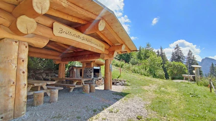
Fancy a delicious afternoon snack after the hike? Visit one of the restaurants Gsässweid, Springenboden or Rothbad on the way back.
Safety guidelines
Your hike takes you through a variety of pastures - always keep your distance from the four-legged alpine residents.
Especially on the last section of the hike, you will need a bit of surefootedness.
Nearby


