Sigriswiler Rothorn


- 4:46 h
- 11.65 km
- 975 m
- 975 m
- 1,077 m
- 2,050 m
- 973 m
- Start: Schwanden, Säge
- Destination: Schwanden, Säge
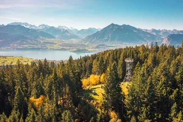
The starting point is the hamlet Säge just after the village of Schwanden. Follow the signpost towards Stampf, passing the drinking water reservoir Stampf, across the alpine pasture to the Stampf alpine hut, and then continue over green meadows and through shady forests to the alp “Oberi Matte”. The next section leads through an impressive spruce forest to the mountain saddle Zettenalp. Here you leave the hilly forest and pasture landscape and climb a steep mountain hiking trail up the Sigriswilergrat, which you reach at the mountain saddle "Stäppli" at an altitude of 1921 m. The path now leads south around the summit of the majestic Rothorn to the signpost at the foot of the Rothorn. From here it is about a 20-minute walk to the summit of the Rothorn at 2051 m, where you can enjoy the magnificent panoramic view from Säntis across all Bernese Alps far into the Jura. The descent first takes us to the very idyllically situated Alp Oberbergli. Immediately below this alp, follow the signpost "Bodmi Stampf Schwanden", cross a small pass and then downhill to the signpost "Berglichäle". From here it goes steeply down to Alp Bodmi, Alp Stampf, and further to the starting point Säge in Schwanden.
Are you looking for more hikes?
You can find more inspiration around hiking opportunities in the Bernese Oberland here.

Good to know
Pavements
Best to visit
Directions
Directions & Parking facilities
Additional information
Feldenstrasse 1
3655 Sigriswil
Tel.: +41 33 251 12 35
sigriswil@thunersee.ch
www.sigriswil-tourismus.ch
Interlaken Tourism
Marktgasse 1
3800 Interlaken
Tel.: +41 33 826 53 00
License (master data)
Author´s Tip / Recommendation of the author
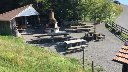
Landgasthof Rothorn in Schwanden offers a selection of refreshing drinks and filling dishes.
Safety guidelines
Nearby


")
Download GPX file