On the 9-Lakes-Hiking in Goms


- 6:50 h
- 18.21 km
- 900 m
- 1,710 m
- 1,345 m
- 2,774 m
- 1,429 m
- Start: Grimsel, pass summit
- Destination: Ulrichen
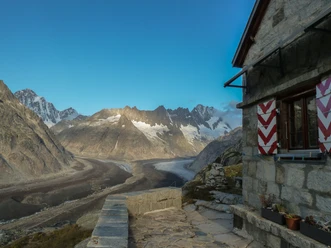
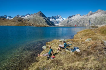
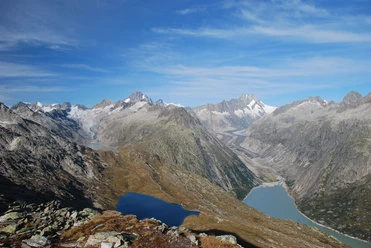
The Grimsel Pass between the Oberhasli and Valais was probably used as a connecting route long before our era. It is always amazing to see that people knew and used our Alpine passes several thousand years ago. As a trade route, the Grimsel Pass along with the adjacent Gries Pass to Italy was particularly important from the Middle Ages until the 19th century. Granite, bedrock, Aarmassif – that sounds like unspoiled landscape, lonely mountains, and pristine nature. A few steps from the pass road, hardly any traffic noise can be heard anymore. A barren primal landscape welcomes us, as the high trail consistently lies between 2100 and 2700 m above sea level: grassland and individual snow remnants, glacier-polished rock slabs, and above that jagged rock needles and fractured peaks, moors, babbling streams, and mountain lakes in the most diverse shades of blue and green. After the Totesee near the pass, the Jostsee with its cottongrass-lined shores is the next gem. Rundsee, Üelisee, and many other mountain lakes enchant us up to the Trützisee. You can follow the marking “9-Lakes-Hiking,” but you also have to sometimes look carefully for the trail in the sparse grass and scree. And always this view! At the beginning, the peaks of the Gärstenhoren behind the Totesee amaze, then some less well-known but no less impressive summits of the Rotondo and Nufenen region can be seen. But also famous peaks like the Mischabel group shine in the distance. After the Trützisee follows the long descent through the Trütz Valley to Ulrichen. At the latest here, during the alpine season, you will surely encounter some black-nosed sheep. Down in the valley, you will sink into a chair on a restaurant terrace and lean back contentedly.
Text: Fredy Joss

Good to know
Pavements
Best to visit
Directions
Grimsel Pass – Jostsee – Rundsee – Trützisee – Ulrichen
Equipment
We recommend the following equipment: sturdy hiking boots, medium-sized backpack with hip belt, sun protection, rainwear, hiking poles, pocket first aid kit, picnic, enough fluids, mobile phone.
Directions & Parking facilities
Arrival: by post bus from Meiringen / Innertkirchen or from Oberwald to Grimsel Pass summit
Return: by Matterhorn-Gotthard-Bahn from Ulrichen
Additional information
Berner Wanderwege, 031 340 01 01, info@beww.ch, bernerwanderwege.ch
License (master data)
Safety guidelines
This route runs entirely or partially on marked paths of the category mountain hiking trail.
Map
swisstopo hiking map: 265T Nufenenpass, 1: 50,000
Nearby