Hiking by the Water - Lauteraar Glacier


- 4:40 h
- 10.33 km
- 900 m
- 183 m
- 1,783 m
- 2,394 m
- 611 m
- Start: Grimsel Hospice or Summerloch
- Destination: Grimsel Hospice or Summerloch
The trail along Lake Grimsel is marked as a mountain hiking trail, and the subsequent ascent to the SAC hut is marked as an alpine hiking trail. One should not underestimate the length and altitude differences of the hike as well as the partly exposed sections along Lake Grimsel.
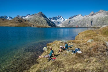
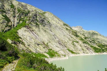
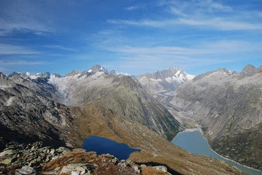
At the Grimsel Hospice, you first cross the dam and then enter a tunnel (flashlight). Afterwards, the mountain path leads along Lake Grimsel for kilometers. The view into the remote and rugged mountain world is impressive. At the end of the reservoir, you reach the former glacier forefield where a first flora gradually spreads. The glacier itself is no longer entered. On the recently created hiking trail, you reach the SAC hut and thus a great panorama of the retreating Lauteraar and Finsteraar glaciers.
Attention: Due to construction work on the dam, access from Grimsel Hospice is partly only possible via Summerloch (parking lot/bus stop)!

Good to know
Pavements
- Path (100%)
Best to visit
- suitableDepends on weather
Equipment
- We recommend the following equipment: sturdy mountain boots, a medium-sized backpack with hip belt, sun protection, rainwear, hiking poles, first aid kit, picnic, sufficient fluids, mobile phone.
Directions & Parking facilities
- Getting there
By car to Innertkirchen. Drive on the Grimsel pass road to the hospice junction and over the dam up to the hospice. Note: The hospice is not at the pass summit!
ParkingFree parking is available at the hospice or Summerloch.
Public transportationOutbound: by train to Meiringen. Then by post bus to Summerloch or Grimsel Hospice.
Return: from Summerloch or Grimsel Hospice by post bus to Meiringen.
Additional information
- Association Bernese Hiking Trails, Bern, Tel.: 031 340 01 01, E-mail: info@beww.ch, Homepage: www.bernerwanderwege.ch
Literature
Hiking suggestion from the free brochure Hiking by the Water, by the Bernese Hiking Trails.
License (master data)
Author´s Tip / Recommendation of the author
- Attention: Due to construction work on the dam, access is partly only possible via Summerloch (parking lot/bus stop below the dam)!
Safety guidelines
In the second part, the access to the hut is marked as an alpine hiking trail. In case of doubt, check the trail condition and difficulty directly with the Lauteraar hut at +41 (0)33 973 11 10
Attention: Due to construction work on the dam, access is partly only possible via Summerloch (parking lot/bus stop below the dam)!
Map
Swisstopo hiking map 255T Sustenpass and 265T Nufenenpass 1:50,000