Karst fields and ponds


- 5:10 h
- 14.25 km
- 950 m
- 880 m
- 1,116 m
- 1,871 m
- 755 m
- Start: Habkern
- Destination: Beatenberg/Waldegg
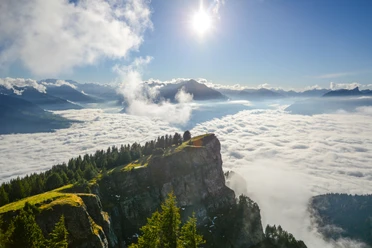
From the Post Habkern, the path goes up into the hillside street, which leads high above the Lammbach valleywards. Shortly after the sawmill, the hard surface ends. The path pulls up steadily to Trogenmoos. Here begins the extensive Seefeld–Hohgant nature reserve, whose wealth of flowers is unparalleled.
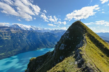
At the rest area at Grünenberg Pass, surrounded by forest, you leave the yellow trail marker and now follow the white-red-white mountain trail signs, which reliably lead through swampy hollows and around jagged limestone bands. In this Nordic-looking, primeval wild landscape lie the huts of Hinter, Mittler and Vorder Seefeld (from here a detour to Chromatte–Habkern is possible: 1h45; partly very steep!). Our path then heads towards the large karst fields at Sieben Hengsten and meets the ridge trail coming over from Niederhorn at Seefeld/Oberberg.
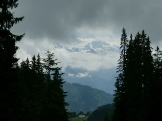
The view from the adjacent Loubenegg into the Bernese high Alps is overwhelming and justifies a long rest. Then the long descent begins via Gemmenalp–Chüematte–Rischeren to Beatenberg/Waldegg.

Good to know
Pavements
- Asphalt (16%)Trail (17%)Path (67%)
Best to visit
- suitableDepends on weather
Directions
- Habkern - Trogmoos - Seefeld - Gemmenalp - Beatenberg/Waldegg
Equipment
- We recommend the following equipment: sturdy mountain boots, medium-sized backpack with hip belt, sun protection, rainwear, hiking poles, pocket first aid kit, picnic, sufficient fluids.
Additional information
- Association Berner Hiking Trails, Bern, Tel.: 031 340 01 01, E-mail: info@beww.ch, homepage: www.bernerwanderwege.ch
License (master data)
Safety guidelines
- This route runs entirely or partly on mountain hiking trails.
Map
- Swisstopo hiking map 1:50'000 254T Interlaken