Winter hiking trail Leiterli - Stoss


- 1:00 h
- 2.97 km
- 7 m
- 320 m
- 1,633 m
- 1,942 m
- 309 m
- Start: Lenk/Leiterli mountain station
- Destination: Lenk / Stoss mid-station
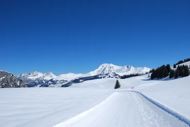
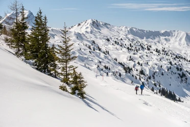
The descent from Leiterli to Stoss is a leisurely path. At the mountain and mid-station, as well as along the way at the Berghaus Betelberg on the Hubel, you can conveniently meet skiers. On the way, you have a good view of the Leiterli – Stoss piste as well as the Leiterli – Stoss sledding trail. The hiking trail is separate and may only be used for walking. Good footwear is needed.

Good to know
Best to visit
Directions
Betelberg/Leiterli - Agematte - Hubel - Stoss
Equipment
We recommend the following equipment: sturdy and waterproof mountain boots, light to medium backpack, cold protection, sun protection, hiking poles, pocket first aid kit, snacks, tea in a thermos flask, mobile phone.
Directions & Parking facilities
Additional information
Berner Wanderwege Association, Bern, Tel.: 031 340 01 01, Email: info@beww.ch, Homepage: www.bernerwanderwege.ch
License (master data)
Author´s Tip / Recommendation of the author
At Betelberg, there is a wide selection of groomed winter hiking trails. Dive in virtually and enjoy at www.betelberg.ch/winterwandern.
Safety guidelines
This route runs on designated winter hiking trails.
Map
Swisstopo national map 1266 Lenk 1:25,000
Nearby