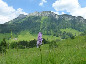
Trogehorn - striking peak in the Hohgant massif


- 5:40 h
- 12.32 km
- 1,130 m
- 1,130 m
- 1,040 m
- 1,969 m
- 929 m
- Start: Innereriz
- Destination: Innereriz
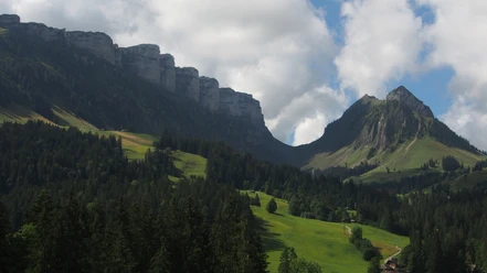
At the road fork, after the bus stop Säge, keep left and follow mostly alpine roads to the Oberbreitwang alpine huts. Here you have a nice view into the Eriz and across to the wooded Honegg. Now follow the Chrinde signposts and after 200 meters continue to a fork in the trail. Keeping right, climb through a slit in the large rock band, the Chrinde, up to the ridge of the Hohgant massif at trail junction P.1968. To the left, the mountain hiking trail continues up for another 15 minutes to the Hohgant west summit. We descend slightly to the right along the ridge and finally over block terrain to the summit of the Trogehorn with its exposed rock block.
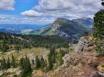
The descent is via the magnificent Arni ridge with a view of the Sieben Hengste. When the ridge fades in the terrain, continue down through the forest and the beautiful moor area at Arni to trail junction P.1521. To the left leads the alpine road to Grünenberg Pass. We turn right and descend on the road to the Fall alpine huts. Keep left here and after 100 meters immediately right again, to return over the Hindere Sol alpine huts back to the starting point Säge.

Good to know
Pavements
Best to visit
Equipment
Directions & Parking facilities
Arrival: by bus from Thun station to Innereriz, stop Säge
Return: by bus from Innereriz, stop Säge to Thun station
Additional information
Literature
License (master data)
Safety guidelines
Map
Nearby
Download GPX file