To the Lobhorn hut SAC - a first-class viewing balcony


- 5:30 h
- 12.33 km
- 688 m
- 1,118 m
- 1,085 m
- 2,156 m
- 1,071 m
- Start: Isenfluh
- Destination: Isenfluh
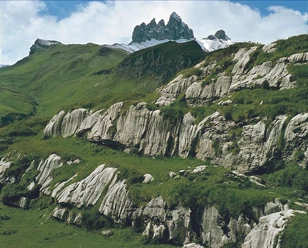
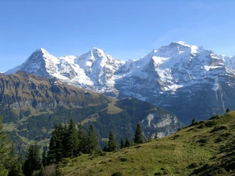
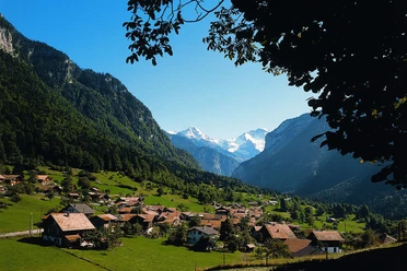
The village of Isenfluh, high above the Lütschine Valley, has been fighting for survival for years. In the sixties, an ever more threatening exodus was countered with the construction of a small road, which fell victim to a severe storm in 1987. Today, a new road leads to Isenfluh, even featuring a hairpin tunnel. From the starting point to the lower station of the Sulwald cable car. Alongside it into the small road and immediately back to the stream. After crossing it, the ascent begins, first near the stream, then along the upper houses of Isenfluh in a southerly direction to the forest. Shortly after entering it, a path branches off along the slope and leads up to Sulwald in many turns, crossing the alpine road twice. Without leaving the forest, at the next path junction turn left and so reach the signpost at Chüebodmi. Leaving the hut to the left, continue upwards. At the forest exit, the magnificent view of the Jungfrau group surprises. The valley end of the Sulstal is formed by the rock spires of the Lobhörner, and nearby, remarkable karst formations in the limestone rock gleam out of the green meadows. Following the Sulsbach, continue upwards to the alpine buildings of Suls (to the Sulsseewli–Bällehöchst 2h20; to Sousläger 1h). A special delight is the short detour (15 min) to the Lobhorn hut SAC, perched in the most beautiful viewpoint, and to the Sulsseewli, famous for its overwhelming reflection (see picture page 62). The wide basin of the Alp Suls, in which several small mountain lakes are embedded, is bordered by the distinctive Sulegg in the west and the Sousegg in the south. Now head towards the latter. The path is only faintly marked, but the alpine hollow indicates the general direction. At the hut on Sousegg (to the Lobhörner 1h20, caution!) the Männlichen and Grindelwald mountains come into view. The descent into the Soustal swings into the Sousböden at the hut and turns around a rock ledge, along a scree slope, towards the Chantbach (caution!). Cross it. Soon you encounter clear path traces again, which lead very steeply down into the Soustal. Then a pleasant valley hike to the houses of Sousläger (to Grütschalp 45 min) and through the forest over Balm back to Isenfluh (to Zweilütschinen 1h).

Good to know
Pavements
Best to visit
Directions
Equipment
Additional information
Literature
License (master data)
Safety guidelines
Map
Nearby
Download GPX file