Through the Frutigspissen


- 6:00 h
- 19.79 km
- 318 m
- 872 m
- 779 m
- 1,357 m
- 578 m
- Start: Adelboden
- Destination: Frutigen
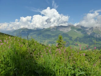
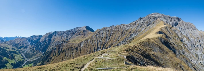
(Description in reverse direction) The ascent through the forest to the terrace of Gempele is extremely steep, where you reach the Spissen path at the edge of the deeply incised Chratzeregrabe. One is surprised to find magnificent, only gently sloping mountain meadows here. With little difference in altitude, the mountain road now swings into the ravine, leads to the particularly narrow Spisse Chratzere and again through a deep incision to Linter. The constant alternation between wooded ravines and open mountain meadows is soothing. On the further path via Ladholz, the path crossing the ravine becomes ever narrower. At Otterebach, you cross the municipal boundary between Frutigen and Adelboden. Gross Lohner and Wildstrubel seem already within reach. Via Egereschwand and Ussere Schwand you reach Adelboden.

Good to know
Pavements
Best to visit
Directions
Adelboden - Rinderwald - Gempele - Rohrbach - Grantibrügg - Frutigen
Equipment
We recommend the following equipment: light trekking shoes, light backpack, sun protection, rain jacket, pocket first-aid kit, light picnic, sufficient fluids, mobile phone.
Directions & Parking facilities
Outbound trip: by train to Frutigen. Then by bus to Adelboden.
Return trip: from Frutigen by train
Additional information
Bern Hiking Association, Bern, Tel.: 031 340 01 01, E-mail: info@beww.ch, Homepage: www.bernerwanderwege.ch
Literature
Hiking suggestion from the hiking book Thunersee - Frutigland, hiking book series of the BWW
License (master data)
Safety guidelines
This route runs entirely on hiking trails.
Map
Swisstopo hiking map 1:50,000 263T Wildstrubel
Nearby