Swissminiatur in the Kandertal


- 3:30 h
- 8.64 km
- 820 m
- 600 m
- 1,596 m
- 2,165 m
- 569 m
- Start: Allmenalp, aerial cableway
- Destination: Sunnbüel, aerial cableway
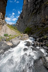
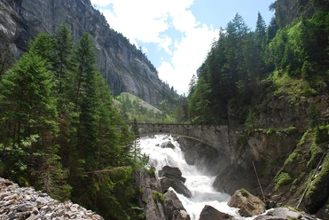
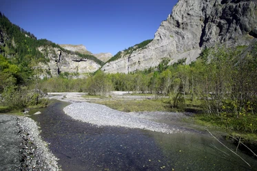
The valley station of the Allmenalp cableway can be reached from Kandersteg station in a quarter-hour walk. At the mountain station, choose the hiking trail via Ryharts to the intermediate goal Usser Ueschene. On this section, the route runs mainly on a pleasantly walkable natural road. This offers ample opportunities to enjoy the view: The view down onto the railway facilities and the village of Kandersteg is reminiscent of the Swissminiatur exhibition in Ticino or a model railway. The peaks of the Lohner chain flank the path on the right. On the left, the Fisistock, Altels, or the Gällihore can be admired. You can briefly peek into the Gastern valley, which is under nature protection. Here, the Kander is left to itself and can carve a new riverbed when the water flow is high. From Usser Üschene, continue on the road to Üschene. Here, turn left towards Gällihore. Now the trail character changes to mountain hiking path but still poses no particular challenges. After crossing the Alpbach, the ascent continues over alpine pastures to the ridge saddle. The descent to Sunnbüel first follows a zig-zag path, then along the slope. The destination of the hike at Sunnbüel is now not far, as the signpost at Alp Winteregg reveals. After a short ascent, you reach the mountain station of the aerial cableway. As a bonus to the hike, consider the walk from the valley station to Kandersteg station.

Good to know
Pavements
Best to visit
Directions
Allmenalp - Ryharts - Usser Üschene - Üschene - ridge saddle – Sunnbüel
Equipment
We recommend the following equipment: sturdy and waterproof mountain boots, light to medium backpack, cold protection, sun protection, trekking poles, pocket first aid kit, snacks, tea in a thermos flask, mobile phone.
Directions & Parking facilities
Outbound: By train to Kandersteg and then by aerial cableway to Allmenalp
Return: By aerial cableway to Eggeschwand and by bus or on foot to Kandersteg station. From Kandersteg by train.
Additional information
Association Bernese Hiking Trails, Bern, Tel.: 031 340 01 01, Email: info@beww.ch, Homepage: www.bernerwanderwege.ch
Literature
Hiking book Panorama hikes of the Bernese Hiking Trails
License (master data)
Safety guidelines
This route runs entirely or partly on marked trails of the mountain hiking path category
Map
Swisstopo hiking map 1:50,000 263T Wildstrubel
Nearby