Ramslauenen Trail


- 2:30 h
- 5.40 km
- 430 m
- 430 m
- 1,404 m
- 1,836 m
- 432 m
- Start: Ramslauenen
- Destination: Ramslauenen
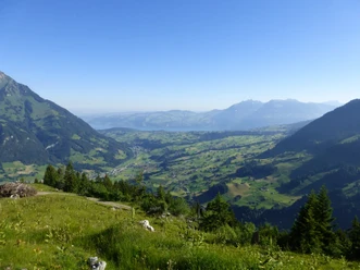
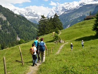
Even the roughly 20-minute chairlift ride up to Ramslauenen is an experience in itself. You glide gently over green slopes and through forests as the view of Lake Thun opens up before you. From Ramslauenen, the Hüttenweg—a round-trip hike of about two and a half hours—first heads toward Bachwald and then continues to the SC Gehrihorn clubhouse. The route then leads from Ober Geerenen to Rüederigs and back to the starting point. Along the way, wooded sections alternate with open alpine meadows, repeatedly accompanied by sweeping views of the Frutig region and across to Lake Thun. Along the trail, various traditional mountain huts dot the landscape, further enhancing its character. This hike is ideal for anyone looking for a relaxed yet impressive tour in the Bernese Oberland who wants to combine nature with panoramic views.

Good to know
Pavements
- Trail (44%)Asphalt (5%)Path (51%)
Best to visit
- suitableDepends on weather
Directions
- Ramslauenen – Bachwald – Ober Geerenen – Ramslauenen
Equipment
- We recommend the following gear: Sturdy hiking boots, a medium-sized backpack with a hip belt, sunscreen, rain gear, hiking poles, a first-aid kit, a picnic lunch, plenty of water, and a cell phone.
Directions & Parking facilities
- Public transportationTake the bus to Kiental, then take the Kiental-Ramslauenen chairlift to Ramslauenen
Additional information
- Bern Hiking Trails, 031 340 01 01, info@beww.ch, bernerwanderwege.ch
License (master data)
Safety guidelines
- This route follows, in whole or in part, marked trails classified as mountain hiking trails.
Map
Nearby
Download GPX file