On the Zulg valley trail

- 1:00 h
- 4.42 km
- 100 m
- 70 m
- 956 m
- 1,047 m
- 91 m
- Start: Linden
- Destination: Innereriz
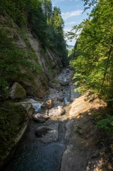
When the Aare below Lake Thun suddenly turns coffee brown after thunderstorms, the wild Zulg is usually involved in this turbidity. In dry weather, one would never suspect its wildness, as it winds gently through mighty gravel banks: a fascinating landscape, an ideal playground for young and old.
It has long seemed desirable to create a hiking trail along this wild stream. However, the wish failed because of the steep, slippery slopes in the middle section of the Zulg's course. After twenty years (!) of efforts, the farthest part of the river course has been opened up with a hiking trail.
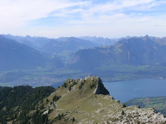
From the hamlet of Linden in Inner Eriz, one descends on a winding little road down to the Zulg at Bieten. Past stately farms and through floodplain woods, you follow the meandering water winding through mighty gravel banks. Especially beautiful is the section opened in autumn 2000 from Bödeli to Inner Eriz / Säge. Especially in autumn, the yellow shining groups of maples contrast wonderfully with the dark forests and the rugged walls of the Hohgant and the Solflue.

Good to know
Pavements
- Asphalt (20%)Trail (48%)Path (33%)
Best to visit
- suitableDepends on weather
Directions
- Linden - Bieten - Bödeli - Innereriz
Equipment
- We recommend the following equipment: light trekking shoes, light backpack, sun protection, rain jacket, pocket first aid kit, light picnic, enough fluids.
Additional information
- Bern Hiking Association, Bern, Tel.: 031 340 01 01, Email: info@beww.ch, Homepage: www.bernerwanderwege.ch
License (master data)
Safety guidelines
- This route runs entirely on hiking trails.
Map
- Swisstopo hiking map 1:50,000 243T Bern and 254T Interlaken