Muggestutz ''Dwarf Trail Mägisalp - Bidmi''


- 2:00 h
- 4.11 km
- 300 m
- 1,427 m
- 1,705 m
- 278 m
- Start: Mägisalp
- Destination: Bidmi
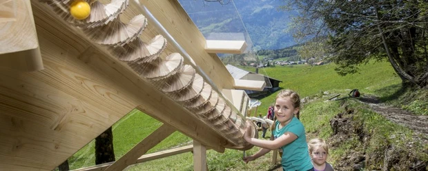
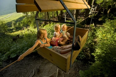
On this dwarf trail, between the mountain station Mägisalp and the middle station Bidmi, Muggestutz experiences countless adventures. Children can playfully follow these experiences at the adventure stations. For example, they find small treasures in a cave, swing high in the air on the eagle swing, and learn a lot about the small lovable creatures. So that the little ones can invest their energy in playing instead of the effort of hiking, the path gently descends over alpine pastures and through fir forests. Several well-equipped fire pits provide wonderful resting opportunities. The second dwarf trail, Käserstatt - Lischen, is listed on the following double page.

Good to know
Pavements
- Trail (75%)Unknown (9%)Street (16%)
Best to visit
- suitableDepends on weather
Directions
Hasliberg/Mägisalp - Gummenalp - Undere Stafel - Hasliberg/Bidmi
Equipment
- We recommend the following equipment: light trekking shoes, light backpack, sun protection, rain jacket, pocket pharmacy, light picnic, sufficient fluids, mobile phone.
Directions & Parking facilities
- Getting thereBy car via Brünigpass to Hasliberg Reuti. Then by gondola lift to Mägisalp.ParkingParking in Hasliberg/Reuti.Public transportation
Arrival: By Zentralbahn to Meiringen and then by aerial cableway to Hasliberg-Reuti. Then by gondola lift to Mägisalp.
Return: By gondola lift from Bidmi to Hasliberg-Reuti.
Additional information
Mountain railways Meiringen-Hasliberg Tel. 033 550 50 50 or at info@meiringen-hasliberg.ch www.meiringen-hasliberg.ch
Literature
- Free brochure ''Hiking with Children'' - available from the Bernese Hiking Trails (info@beww.ch)
License (master data)
Author´s Tip / Recommendation of the author
- Suitable for children from 5-12 years. Not suitable for strollers. Restaurants on the Mägisalp in Bidmi and Reuti. Several picnic areas with fire pits along the hiking route.
Safety guidelines
- The theme trail runs exclusively on marked trails of the category hiking trail.
Map
- Swisstopo hiking map 1:50,000 255T Sustenpass