Family hike with views


- 1:40 h
- 5.74 km
- 61 m
- 520 m
- 1,829 m
- 2,230 m
- 401 m
- Start: Hasliberg, Planplatten
- Destination: Hasliberg, Käserstatt
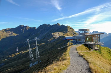
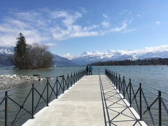
Why the designation "In the heart of Switzerland"? Because the Aelggi-Alp, the midpoint of Switzerland, is only a few kilometers from Hasliberg. The opening of the railway line over the Brünig Pass in 1888 and the road to the Brünig Pass in 1907 enabled the development into today's tourist destination. The four villages Hohfluh, Wasserwendi, Goldern, and Reuti stretch over nine kilometers. The municipal area extends from the Engstlenalp to the Brünig Pass. Every year on the last Sunday of July, the Brünigschwinget wrestling event takes place here. The journey by mountain railway delights young and old alike. At the Planplatten mountain station, also known as Alpen tower, a visit to the terrace is worthwhile to enjoy the view towards the west. The view stretches over Lake Brienz, the Haslital valley floor, and snow-covered mountain peaks. The route is marked from the starting point to the Käserstatt destination.
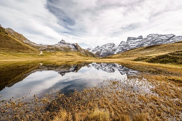
From Planplatten, the hike is marked towards Käserstatt. Past the Planplatten saddle, the path descends over meadows to Hääggen, past Leitistöck, and then down a mountain trail through alpine pastures to the hiking destination at the Käserstatt mountain station of the gondola down to Twing.

Good to know
Pavements
- Path (92%)Trail (8%)
Best to visit
- suitableDepends on weather
Directions
- Planplatten – Hääggen - Käserstatt
Equipment
- We recommend the following equipment: sturdy mountain boots, medium-sized backpack with hip belt, sun protection, rain gear, trekking poles, first aid kit, picnic, sufficient fluids, mobile phone.
Directions & Parking facilities
- Public transportationOutbound: By train via Interlaken Ost to Meiringen, then by aerial cableway over Hasliberg Reuti and Mägisalp to Alpentower (Planplatten). Return: by gondola from Käserstatt to Twing, then by bus to Brünig – Hasliberg and then by train.
Additional information
- Association Bernese Hiking Trails, Bern, Tel.: 031 340 01 01, E-Mail: info@beww.ch, Homepage: www.bernerwanderwege.ch
Literature
- Hiking book short hikes 2 of the Bern hiking trails, order at: https://www.wanderplaner.ch/sommer/web-shop/
License (master data)
Safety guidelines
- This route runs entirely or partially on marked paths of the mountain hiking trail category.
Map
- Swisstopo hiking map 255T Sustenpass 1:50,000, order at: https://www.wanderplaner.ch/sommer/web-shop/